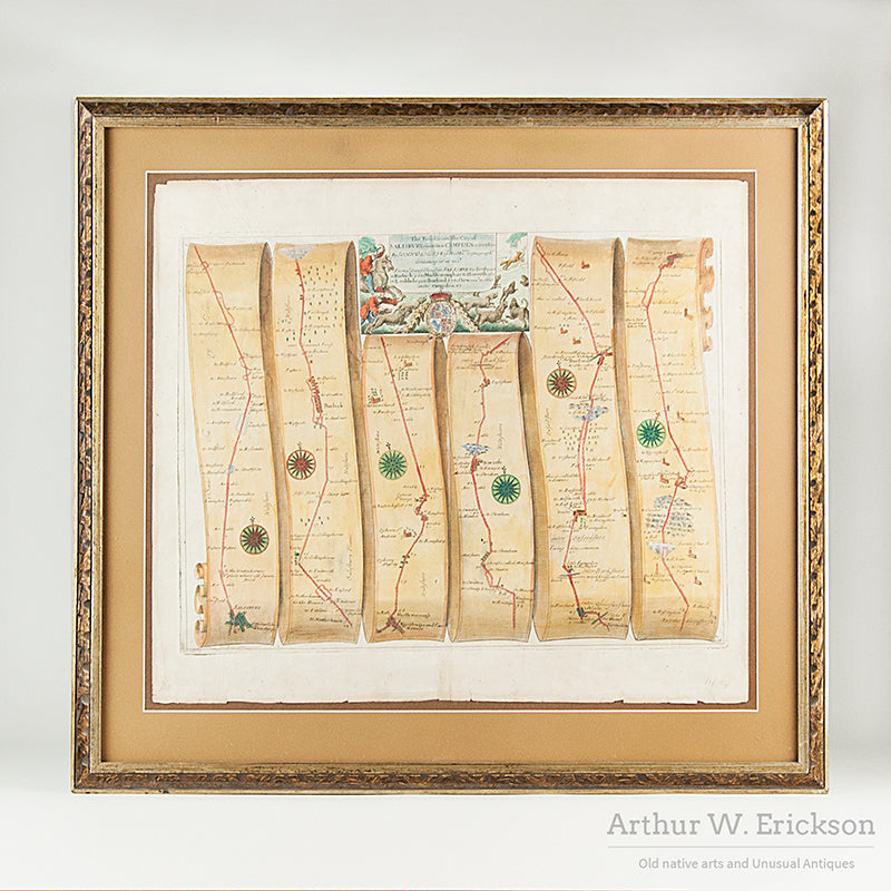
1675 Strip Map of the road from Salisbury to Campden, England, Framed
$ 400.00
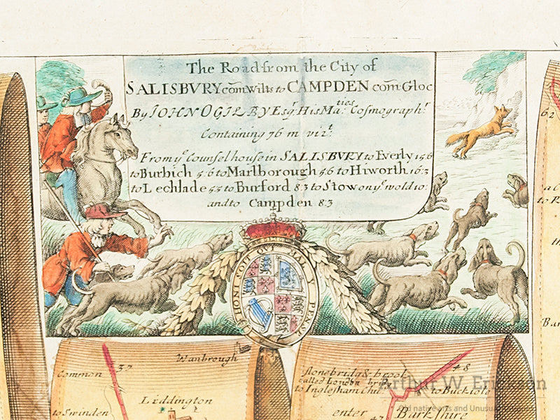
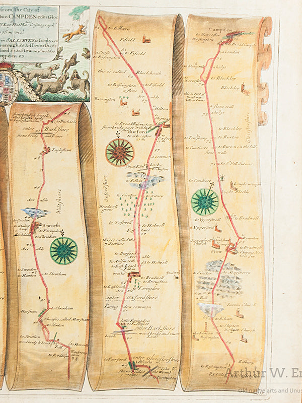
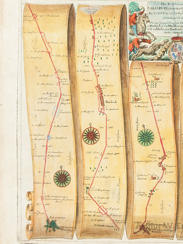
If you are contemplating a trip to merry old England in the near future, you may need this map, particularly if you intend to travel between Salisbury and Campden. The churches, villages, woods, and hills are all noted for your convenience. Of course there may have been a few changes over the last 300 or so years. This was the modern road map of its time and was one of a hundred folio sized strip maps entitled "Britannia" which depicted to scale the major roads in England by John Ogilby (1600-1676). The map has a hand colored cartouche at the top with a list of the major towns on the road between Salisbury and Campden and an illustration of a fox hunt. This is map number 85. A wonderful visual piece of history to enjoy.
L. 19 ½"; W. 16 ¾"; Frame 24 ¾" x 22 ½"
Share this item: